

Connecticut Rail System
Connecticut has a fairly robust commuter rail system. But strangely, it’s not perceived that way — in large part because the state treats its three rail lines as somewhat distinct entities. In this thought exercise, I wanted to explore whether unifying the state’s rail network into one system could help to change the perception of transit.
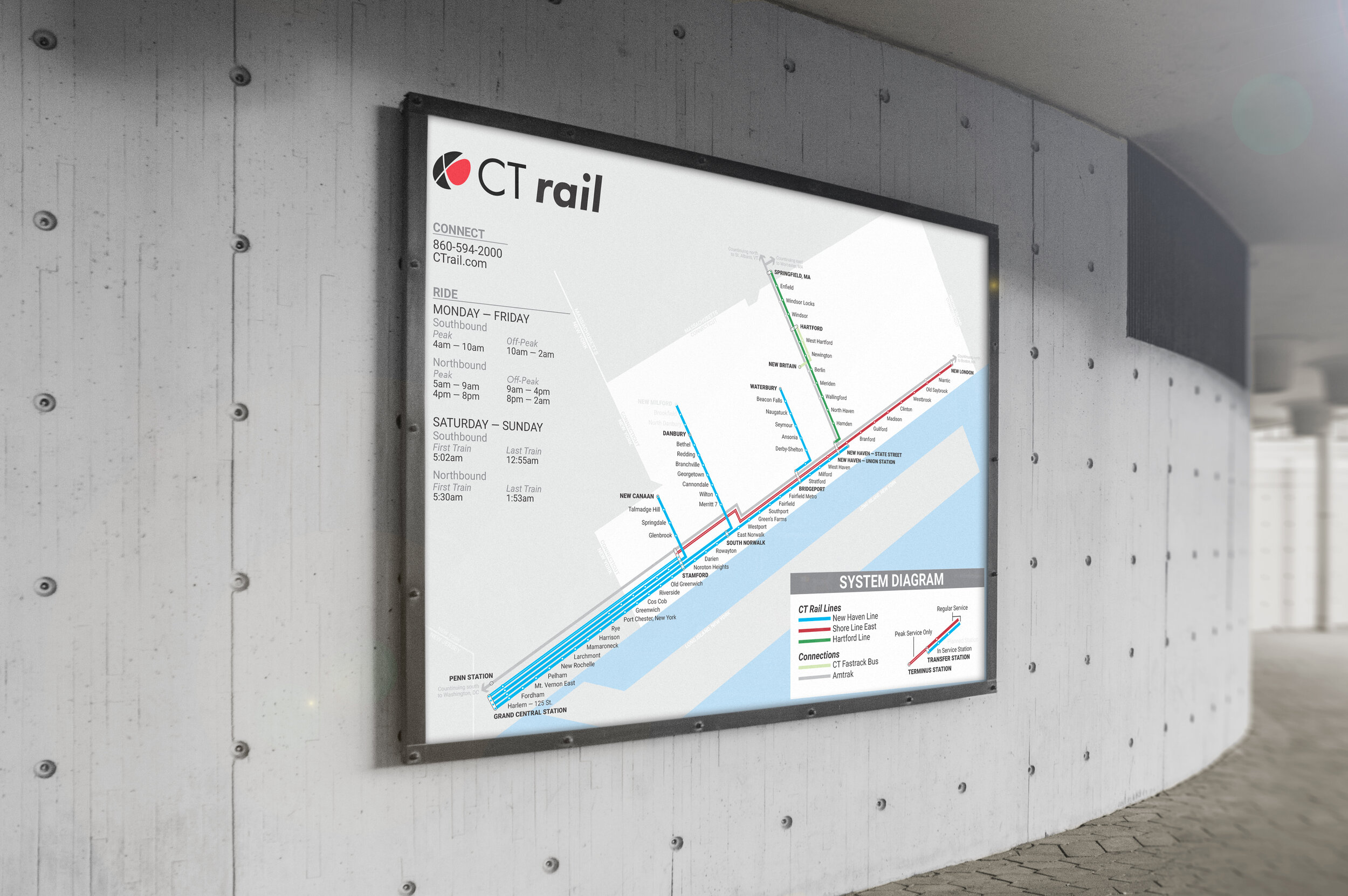
Making it easier to get around.
The current approach to rail in Connecticut is highly balkanized and makes it harder to tell just how easy it is to use transit to commute around the state. I propose a system map that unifies disparate rail lines. I offered clearer rider journeys by favoring diagrammatic (over geographic) accuracy, as well as by rotating and placing the grid on 30º to allow all labels to be placed horizontally. The result is far more legible than the official version — and has been reviewed positively online by experts in wayfinding and was received well when put through light testing (feedback received from riders of the New Haven and Hartford Lines).


